 Deutsch
 English
 Español
 Français
 Italiano
 Nederlands
 Polski
 Português
 Русский
 Türkçe
 Svenska
 Chinese
 Magyar
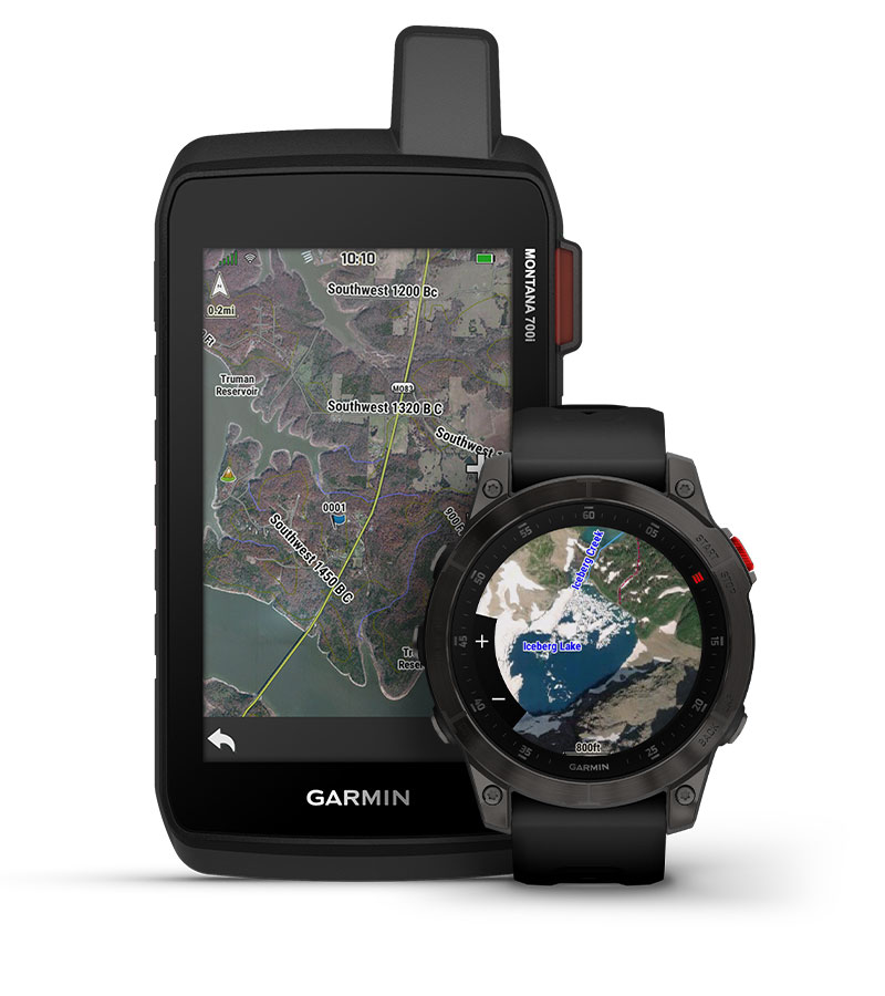
Garmin Outdoor Maps+ with satellite images has just arrived

A new Garmin Outdoor Maps+ feature is now available for various smartwatches. The mapping tool is offered via a subscription, providing users access to the latest maps on their wearable. The maps are designed to work alongside pre-existing features, adding satellite imagery to make finding land features or waypoints easier.
The Garmin Outdoor Maps+ upgrade also brings improved TOPO maps for greater elevation detail, and the National Hydrography Dataset can show you rivers and streams nearby. State plat maps can inform you of boundaries to private land, and a color-coded public land map overlays details where you can walk freely. Plus, Raster maps can point you towards campaign areas and sources of water. Garmin claims it will regularly update the map content, pushing the latest version to subscribers’ smartwatches.
The Garmin Outdoor Maps+ is now available for the Enduro 2, epix (Gen 2), fenix 7 series, MARQ (Gen 2), quatix and tactix 7 series smartwatches. You can also download the tool on the Montana 700, 700i and 750i handheld GPS, with the new feature was launched for these devices late last year. The annual subscription costs US$49.99; a monthly plan is not currently offered and the tool is only available in the US. Whether or when the Garmin Outdoor Maps+ feature will launch in other markets is unclear.

Source(s)


