NASA's new tech finally lets the Perseverance rover track its location in real time
NASA’s Perseverance rover has been exploring Mars since 2021. While moving around the red planet, the rover takes pictures of its surroundings every few feet while accounting for wheel slippage. However, small errors build up over time. On long drives, the rover can be off by more than 100 feet (up to 35 meters). When this happens, the rover stops, thinking it might be near dangerous terrain. It then waits for instructions from Earth — a process that can take a day or more. The new technology called Mars Global Localization bypasses this time-consuming process.
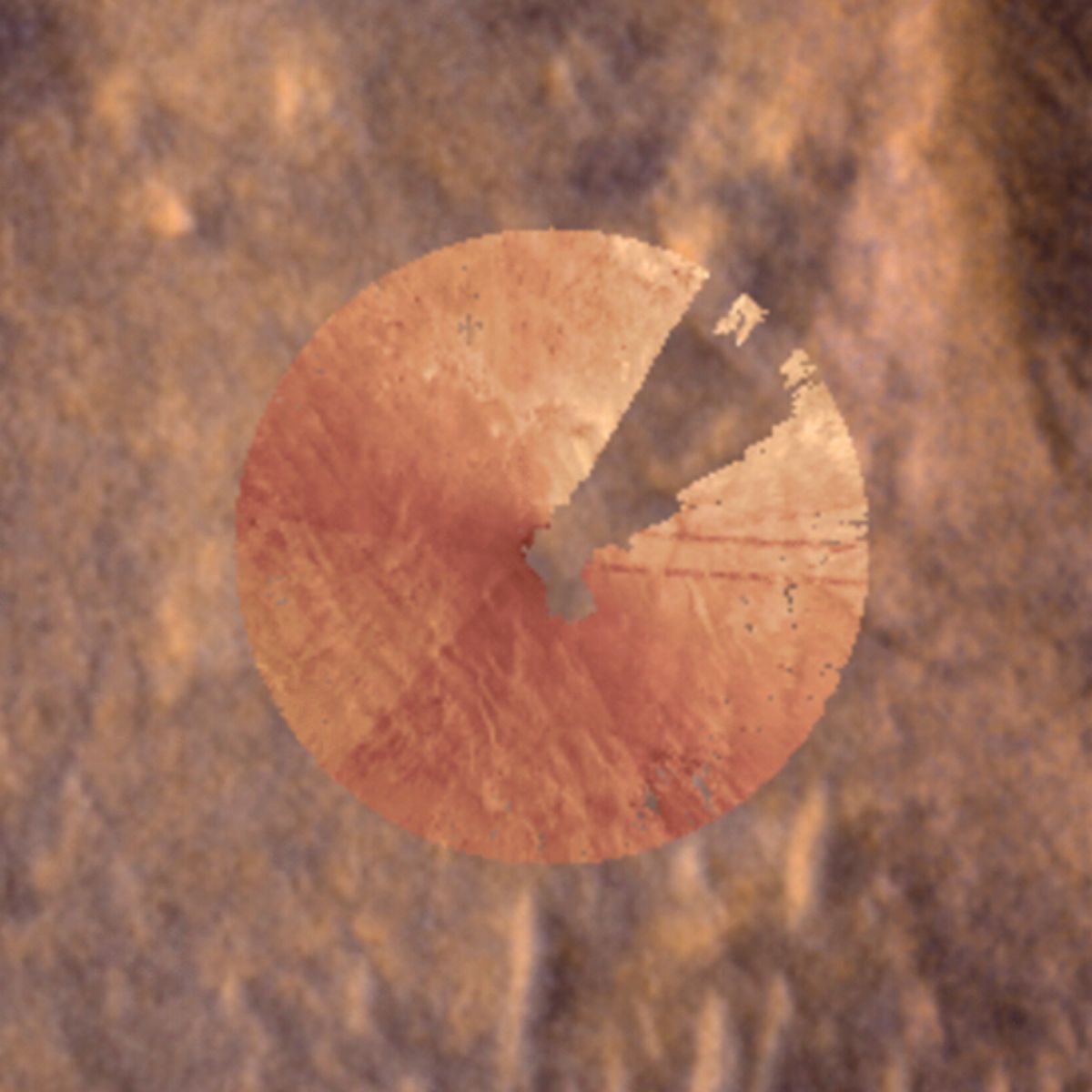
On February 2, navigation cameras (navcam) on Perseverance took a 360-degree view of the surrounding terrain in a location dubbed “Mala Mala.” This region is a featureless location on the rim of Jezero Crater. The images were stitched into an overhead circular image called an orthomosaic. An onboard algorithm then matched the image to orbital images from the Mars Reconnaissance Orbiter (MRO). This helped the rover pinpoint its location with an accuracy of 10 inches. And the entire process took only about two minutes.
The algorithm runs on a processor that Perseverance previously used to communicate with the now-retired Ingenuity Mars Helicopter. It allows Perseverance to determine its own location and continue on its pre-planned route without having to stop and wait for instructions.
