Apple returns to surveying streets with futuristic backpacks
Users of navigation apps like Google Maps or Apple Maps for iPhones (from US$574 on Amazon) often assume that the map material for the useful applications is usually gathered by satellites which can take highly detailed pictures of the earth's surface. It is also known that Google and Apple use cameras that are mounted on the roof of cars in order to gather street level imagery for their respective navigation apps.
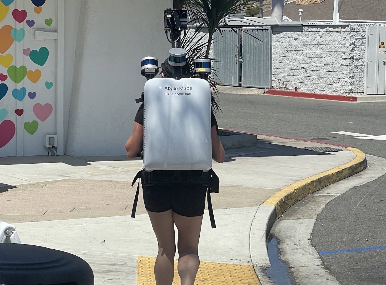
However, under special circumstances Apple occasionally sends its employees to walk the streets of certain big cities with futuristic camera backpacks, as we reported a few years ago. According to MacRumors, this is supposed to happen again in Canada's three biggest cities over the coming weeks. In Toronto, Montréal and Vancouver, Apple employees may hit the streets with their eye-catching backpacks.
Apple is using the gathered material to improve its "Look Around" feature, which stands in direct competition to Google's popular street view mode in Google Maps. Since the cars that are usually used to gather this data cannot reach every part of modern cities, employees now have to walk to fill the gaps in Apple's map material. The Cupertino-based iPhone maker also assures that privacy plays an integral role in this collection of data, which is why the faces of pedestrians and the license plates of cars will be blurred.
Source(s)
MacRumors, Image: Joanna Stern
