Lost for 1,000 years: LiDAR might have uncovered a long-lost city
Madinat al-Zahira remains one of the enduring mysteries of Islamic Spain. Founded in the 10th century by Almanzor as a new political and military center, the city was plundered and destroyed after his death in 1010, then deliberately erased from memory. For centuries, its exact location remained unknown. Numerous theories have emerged over time – but until now, none have been backed by concrete evidence.
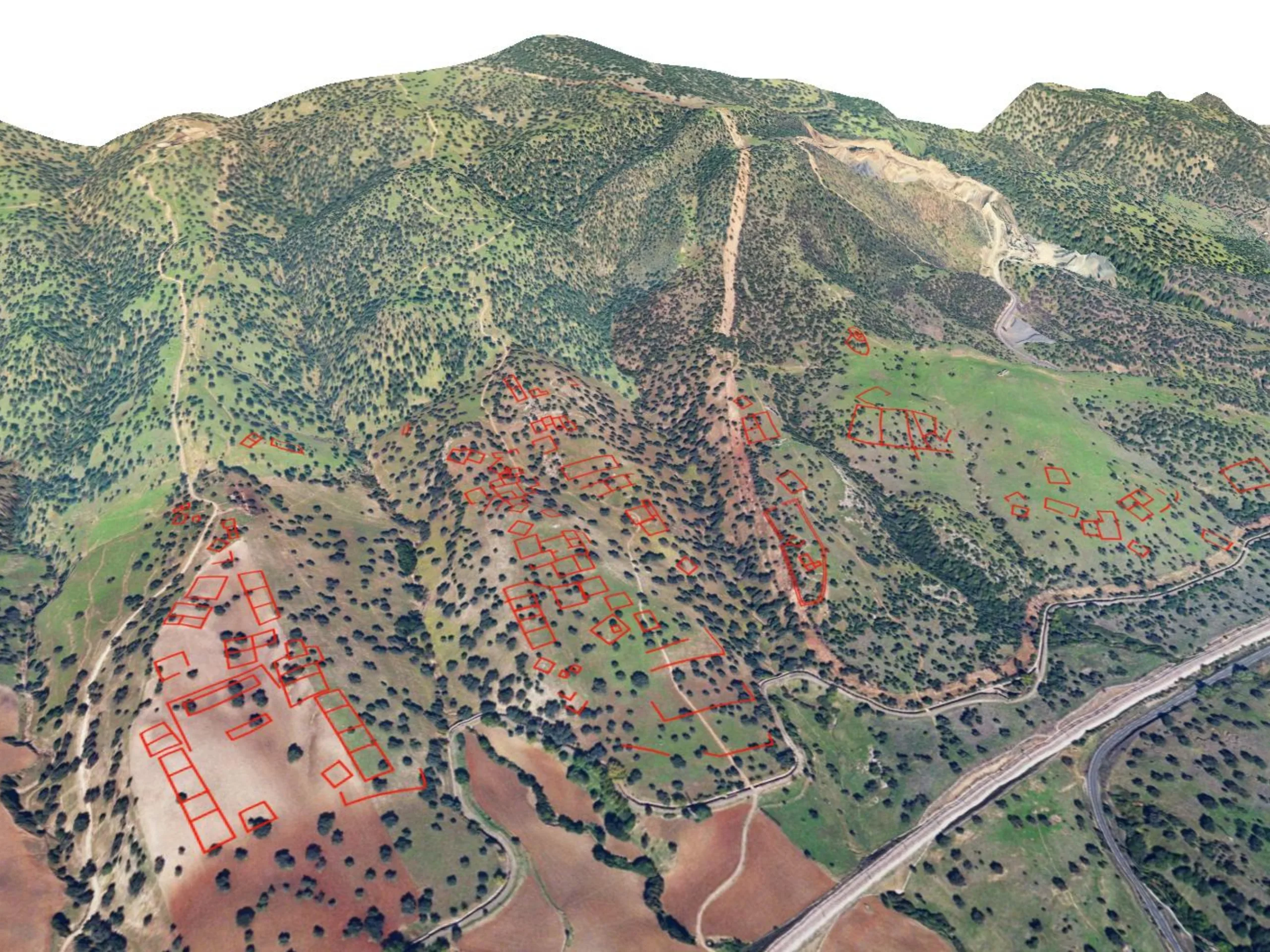
A research team from the Universidad de Córdoba (in Spanish) has used modern LiDAR technology to identify a possible location of the lost city – east of Córdoba, in the area known as Cabezos de las Pendolillas. According to the data, the site features a carefully planned urban layout spanning around 120 hectares, with rectangular structures, terraces, and a largely grid-based design – closely matching historical descriptions of Madinat al-Zāhira.
The researchers used LiDAR (Light Detection and Ranging), a technology many people may recognize from modern robot vacuum cleaners. Instead of mapping furniture and walls, however, the system scanned the ground from the air. Millions of laser pulses measured subtle variations in elevation, revealing structures no longer visible to the naked eye. Notably, the method can detect remains even when they are buried beneath soil or concealed by vegetation.
No excavations have taken place so far, but the sensor data strongly suggests that the site may be the lost city of Madinat al-Zahira. If confirmed, the discovery would represent a major archaeological breakthrough. For now, however, there is no indication of when – or if – excavations will begin.
Source(s)
University of Córdoba (in Spanish)
