Observing the starry sky at night is an activity enjoyed by millions of people around the world. However, it quickly becomes limited if you don't have quality equipment such as astronomical glasses, binoculars, or telescopes.
Fortunately, there is good news on this front. Researchers in the United States have developed the most comprehensive interactive map, allowing you to observe galaxies and stars without leaving your home. In addition, information is available on the celestial bodies you are interested in, helping you to learn a great deal.
However, this type of map has been around since 2018. At that time, the European Space Agency (ESA) had developed a huge, detailed map as part of the Gaia mission. On this map, it was possible to see the Milky Way with billions of stars, some of which are 1.5 million kilometers from Earth. In addition, 14,000 asteroids orbiting in the solar system were visible.
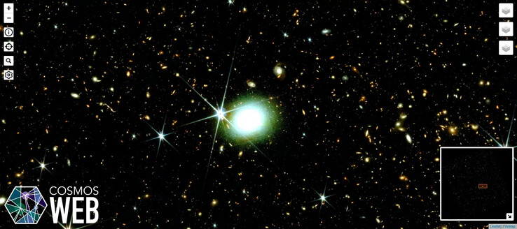
But recently, as part of its COSMOS-Web program, the California Institute of Technology in the United States has achieved another feat. It has succeeded in producing the largest interactive map of the sky ever created. And that's not all, because this document is not only intended for scientists, but is also accessible to amateurs and curious minds.
To achieve this result, researchers had to use data from the James Webb Space Telescope, which continues to revolutionize our observation and understanding of the universe. As a result, no less than 1.5 TB of data has been incorporated into this document, producing a breathtaking result. Although the surface area covered is only 0.54 square degrees of the sky, it is possible to see hundreds of galaxies, some of which are located 13 billion light-years away, dating back to the birth of our universe.
Navigating it is as easy as using Google Earth or Google Maps. In addition, there are filters available to help you display or hide certain elements.
Source(s)
Sciencepost (in French)


